Avian Migration Corridor Identification
| for | Echotrack Inc |
| status | pilot study complete |
| as of | August 2011 |
Choosing study sites for radar-mapping of migrating birds by identifying possible migration routes from BC landforms.
Echotrack Inc. is working with a Danielle Dagenais at the University of British Columbia to study the migration patterns of birds across the province of British Columbia. Some migration routes are known but there may be a considerable degree of confirmation bias currently effecting choices of bird spotting and banding locations. A broader study using radar as a method to directly observe avian flights could expand understanding of migration routes, and how birds choose those routes according to the landforms they fly over.
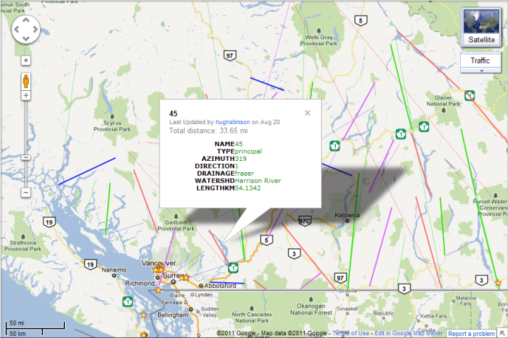
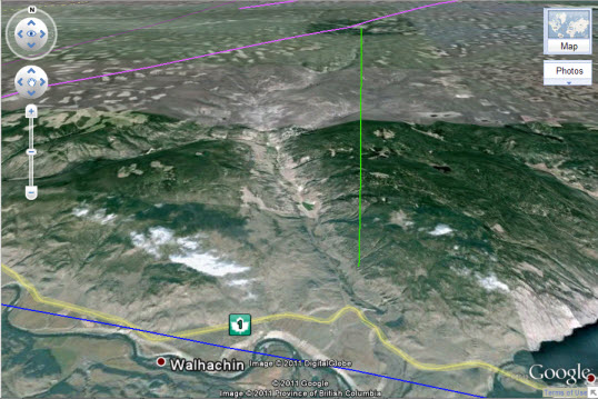
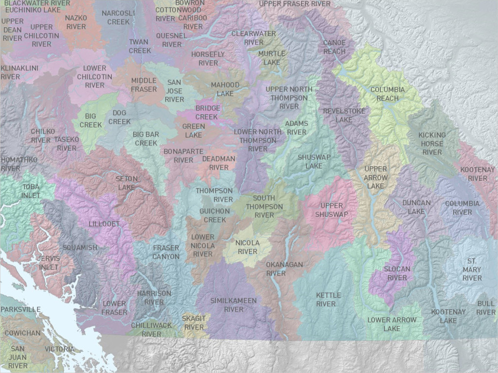
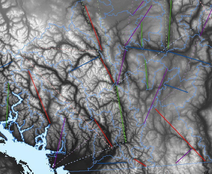
Geocology worked with Echotrack to identify a series of radar study locations for a pilot project sensing bird flights through the valleys of southern interior British Columbia. Digital elevation model (DEM) data for the entire provinced was subset using major watershed groups, and the most substantial valley was identified for each. The cardinal direction of each possible route was determined programmatically. These potential migration sub-corridors were then mapped conventionally and in Google Earth to allow for effective route and site planning for the research campaign.
Now that an initial radar flight sampling campaign is complete, Geocology is working with Echotrack to quantify the degree to which bird flights occurred in habitat types which have traditionally been sampled using conventional mist-netting and banding techniques, and which flights occurred outside of those habitats, or in regions which have not previously been sampled at all.